The trial Groundwater Flood Warning Service changes that. It gives residents in the seven Project Groundwater communities currently supported by the service access to daily groundwater flood risk information, current and forecast groundwater levels, and practical advice on how to respond. It has been built with community input from the start.
We've made a new round of updates based on previous feedback. Now we need your help to check whether the latest changes work, and to make sure local flooding experience is at the heart of how the service develops.
Your input matters. The communities that use this service should shape it – and this is your chance to do that.
Here's how to get involved – you can do either one or both:
Test the updated service
Access the updated service, explore the changes, and complete a short survey. It takes around 10-15 minutes, can be done at home on a phone or laptop, and your answers are saved as you go – so there's no need to do it all in one sitting.
You don't need any specialist knowledge. Whether you're new to groundwater flooding or have been living with it for years, your perspective matters.
Share a flooding story
Behind every flood event is a community that dealt with it – the disruption, the damage, the uncertainty of not knowing when it would end or happen again. Those experiences shouldn't be forgotten. Sharing them with us means they won't be.
You can submit details of flooding events that have affected your area, including when it happened and what the impact was. You can also upload pictures.
Want to find out more about the Groundwater Flood Warning Service before you get started?
Visit here for more information
The proposed updates seen on the test site are:
- Clearer explanations of local borehole readings and forecast groundwater levels
- Updated Community Hub and Groundwater data pages to give more context
- New best-case, most likely and worst-case forecast views
- Improved graphs and data displays to make conditions easier to understand
- Planned addition of real community stories linked to high groundwater levels
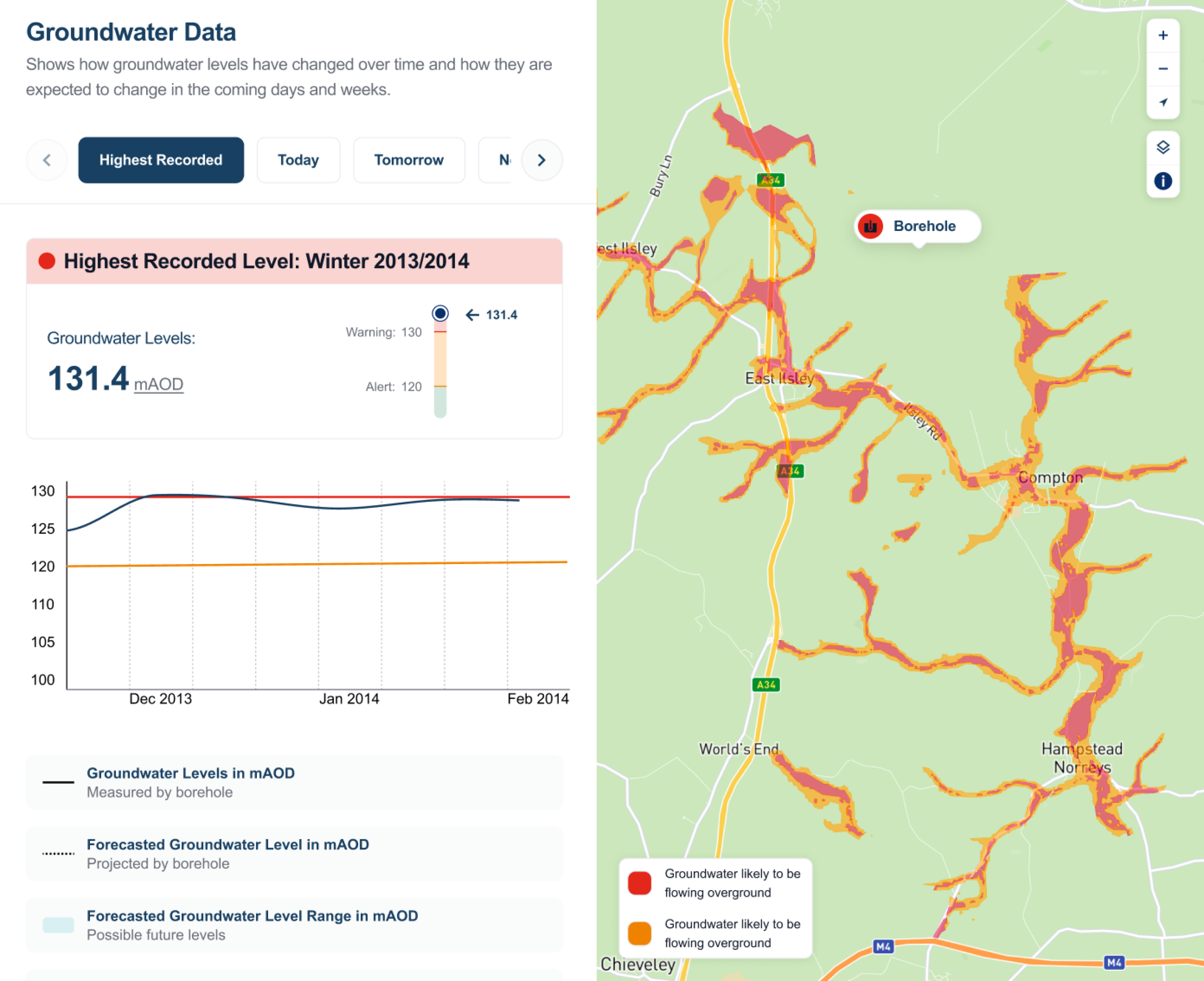
The image above shows a screenshot of our Groundwater Data page, previously known as Flood Map - click to enlarge
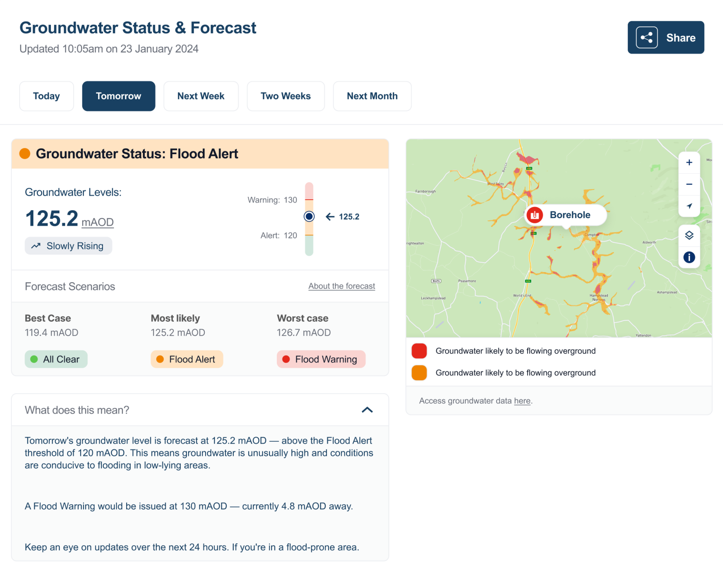
The image above shows a screenshot of the Community hub page during a fake flood alert - click to enlarge
Please note that the test data is fake, designed to simulate a period of high groundwater levels. The EA Alerts section has been left blank, as we’re unable to simulate those alerts
Is the service available in my area?
The trial service is currently available in seven Project Groundwater communities: Chalfont St Peter, Chesham and Marlow in Buckinghamshire; the Pang Valley and Lambourn Valley in West Berkshire; Kimpton in Hertfordshire; and Luton in Bedfordshire.
Even if you live outside these areas, you can still take part in testing and share a flooding story.
About the Groundwater Flood Warning Service
The service was launched in 2024 by Project Groundwater, developed in partnership with 3 Sided Cube, Jacobs and the British Geological Survey. Groundwater level forecasts are updated daily by the BGS, using measured groundwater levels from the Environment Agency and weather forecasts from the European Centre for Medium-range Weather Forecasts. When levels pass the trigger point for flood risk, automated alerts are sent by text or email to registered users.
Project Groundwater is a six-year programme working with communities across 9 high-risk flood areas of the Chiltern Hills and Berkshire Downs, led by Buckinghamshire Council in partnership with five other local authorities and Flood Community Groups. It is funded by Defra as part of the £200 million Flood and Coastal Innovation Programmes, managed by the Environment Agency.